Map Collections at UCD and on the Web: Historic Maps Carlow - Wicklow
Find, access and purchase maps at UCD Library. Lists of map resources and suppliers on the web. Examples of map symbols and scales. Copyright and booking forms.
Ordnance Survey Ireland (OSI) 19th Century Historical Maps
 |
A collection of mainly 19th century maps of almost 150 cities, towns, and villages in the Republic of Ireland. Most are Town Plans which were surveyed at either five or ten foot to one mile scale between 1837 and 1896. The remainder were produced by enlargement of the 1/2500 maps between 1892 and 1911. View the entire collection online in the UCD Digital Library 1 |
|
Killeshin Church, Carlow, 1873 |
-
How to Find and Print a 19th Century OSi Historical Map from UCD's Digital LibraryThe UCD Digital Library includes a collection of Ordnance Survey Ireland 19th century maps of towns, cities, villages. This PPT shows how to find and print extracts from these maps.
Historical Maps by County

Carlow
-
Carlow Town - Ordnance Survey MapsRange of the 1873 and 1907 maps for Carlow Town,
-
1630 - CarlowUdrone Irlandiae in Caterlagh Baronia.[Barony of Idrone in County Carlow] By Johannes Cloppenburg.
-
1703 - CarlowSurvey of Carlow [Town] by Thomas Moland.
-
1728 - The Counties of Wicklow, Carlow and Wexfordby Hermann Moll. Title on the map is 'The Counties of Wicklow, Catherlogh, and Wexford' 'With the Great Roads and Principal Cross-Roads, shewing the computed Miles from Town to Town'.
-
1735 - CarlowCarlow [Town] by Charles Colombine.
-
1776 - CarlowAn Hibernian Atlas by Bernard Scale. County Carlow is Plate 11 which is on page 39 of this digital version. General description of the county is on page 38.
-
1824 - A map of the county of CarlowBy William Allen.
-
1880 - Map of BagenalstownScale: three inches to one statute mile. Created by Ordnance Survey of Ireland. Published for the Municipal Boundaries Commission. The Municipal Boundaries Commission was established by the House of Commons to determine the boundaries and ward divisions of boroughs electing members of parliament.
-
1880 - Map of Carlow [Town]Scale: three inches to one statute mile. Created by Ordnance Survey of Ireland. Published for the Municipal Boundaries Commission. The Municipal Boundaries Commission was established by the House of Commons to determine the boundaries and ward divisions of boroughs electing members of parliament.
-
1898 - Counties Carlow, Kildare and Wicklowby Ordnance Survey Ireland. Map includes Dunlavin, Baltinglass, Rathdangan and Ballitore. Sheet 129. Scale one inch to one mile.
Cavan
-
1910 - Arvaghby Ordnance Survey. Five feet to one mile.
-
1911 - Bailieboroughby Ordnance Survey. Five feet to one mile.
-
1909 - Ballyconnellby Ordnance Survey. Five feet to one mile.
-
1910 - Ballyjamesduffby Ordnance Survey. Five feet to one mile.
-
1909 - Bellananaghby Ordnance Survey. Five feet to one mile.
-
1880 - Map of BelturbetScale: three inches to one statute mile. Created by Ordnance Survey of Ireland. Published for the Municipal Boundaries Commission. The Municipal Boundaries Commission was established by the House of Commons to determine the boundaries and ward divisions of boroughs electing members of parliament.
-
1909 - Belturbetby Ordnance Survey. Five feet to one mile.
-
1685 - CavanBy Sir William Petty. From the Hiberniae Delineatio: Atlas of Ireland. This link is to the online Virtual Record Treasury of Ireland website. Scroll down the page and click on the blue button View Digital Content to see the map images.
-
c 1700 - The whole of the counties of Meath and Louth, with parts of the counties of Dublin and CavanA colored map of part of Ireland, comprehending the whole of the counties of Meath and Louth, with parts of the counties of Dublin and Cavan, divided into twenty-four baronies, on a scale of 160 perches to an inch.
-
1776 - CavanAn Hibernian Atlas by Bernard Scale. County Cavan is Plate 30 which is on page 77 of this digital version. General description of the county is on page 76.
-
1802 - CavanBy Charles Coote. This sketch map is included in his publication Statistical Survey of the County of Cavan.
-
1846 - Cavanby Samuel Lewis. From Lewis's Atlas comprising the counties of Ireland, and a general map of the kingdom.
-
1880 - Map of CavanScale: four inches to one statute mile. Created by Ordnance Survey of Ireland. Published for the Municipal Boundaries Commission. The Municipal Boundaries Commission was established by the House of Commons to determine the boundaries and ward divisions of boroughs electing members of parliament.
-
1883 - 1909 - Cavan Townby Ordnance Survey. Five feet to one mile.
-
1880 - Map of CootehillScale: three inches to one statute mile. Created by Ordnance Survey of Ireland. Published for the Municipal Boundaries Commission. The Municipal Boundaries Commission was established by the House of Commons to determine the boundaries and ward divisions of boroughs electing members of parliament.
-
1910 - Cootehillby Ordnance Survey. Five feet to one mile.
-
1909 - Killashandraby Ordnance Survey. Five feet to one mile.
-
1910 - Kilnaleckby Ordnance Survey. Five feet to one mile.
-
1911 - Kingscourtby Ordnance Survey. Five feet to one mile.
-
1910 - Mullaghby Ordnance Survey. Five feet to one mile.
-
1910 - Shercockby Ordnance Survey. Five feet to one mile.
-
1909 - Swanlinbarby Ordnance Survey. Five feet to one mile.
-
1911 - Virginiaby Ordnance Survey. Five feet to one mile.
Clare
- 1685 - County of ClareBy Sir William Petty.
- 1728 - The Counties of Clare and LimerickBy Hermann Moll. 'With the Great Roads and Principal Cross-Roads, shewing the computed Miles from Town to Town'
- 1752 - ClareBy John Mount and Thomas Page. A chart of the Bay of Galloway and River Shannon. [This map shows part of the Clare coastline and includes The Aran Islands]
- 1787 - Clareby Henry Pelham. This map was commissioned by the Grand Jury of County Clare. The original map is 6 feet by 6 feet and surveyed at 1½ inches to the mile - it is presented here are 6 separate jpegs.
- 1847-1848 - Towns in ClareThese Valuation Town Plan Maps 1847-1848 are signed by Richard Griffith
Corofin
Newmarket on Fergus
Clarecastle
Carrigaholt
Cooraclare
Killaloe
Kilkishen
Broadford
Labasheeda
Tulla - 1855 - 1970 - ClarecastleValuation maps of Clarecastle, part of the transcribed Clarecastle Cancelled/Revision books which come from eight handwritten ledgers, maintained by the Valuation Office.
- Ennisby Brian Ó Dálaigh , published by the Royal Irish Academy, 2012. Irish Historic Towns Atlas No. 25. ISBN 9781908996008
- 1880 - Map of EnnisScale: one inch to one statute mile. Created by Ordnance Survey of Ireland. Published for the Municipal Boundaries Commission. The Municipal Boundaries Commission was established by the House of Commons to determine the boundaries and ward divisions of boroughs electing members of parliament.
Cork
-
-
1820s - Bandon, CorkMap and survey of section of the Bandon River and streams showing weirs and bridges. [Bandon Estate Papers]
-
1823 - Bandon, CorkSurveyed by George Sullivan. Map and survey of part of lands of Kilbrogan, near Bandon, County Cork [Bandon Estate Papers]
-
1880 - Map of BandonScale: two inches to one statute mile. Created by Ordnance Survey of Ireland. Published for the Municipal Boundaries Commission. The Municipal Boundaries Commission was established by the House of Commons to determine the boundaries and ward divisions of boroughs electing members of parliament.
-
Bandonby Patrick O'Flanagan, published by the Royal Irish Academy, 1988. Irish Historic Towns Atlas No. 3. ISBN 0901714747
-
Digital Atlas of Cork CityThe Digital Atlas of Cork/Corcaigh created by the Royal Irish Academy, showcases 6,245 features, categorised by theme, of Cork City’s history from AD 623 through to 1900.
-
1545 - Plan of Cork CityEngraved on a stone by P.J. Klasen from an earlier sketch.
-
1585 to 1600 - Cork CityFirst produced in Pacata Hibernia.
-
1601- Towne of CorkeBy George Carew. Map is from the ‘Hardiman Atlas’ in the Library of Trinity College Dublin.
-
1610 - The Province of MunsterInsets show the city of Cork and the city of Limerick. Prepared for John Speed's 'The Theatre of the Empire of Great Britaine', which was published in 1611/12.
-
Cork City - 15th to 20th Century Map CollectionA range of almost 40 maps of Cork city from the 16th to the 20th century. Some maps include the environs of Cork city. These are hosted on the Cork Past and Present website organised by Cork City Libraries.
-
1690 - The City of CorkDates from around the time of the Siege of Cork by the Duke of Marlborough.
-
1750 - Plan of the City of CorkBy Charles Smith. This map first appeared in his publication 'The ancient and present state of the county and city of Cork'.
-
1771 - A survey of the city and suburbs of CorkBy John Rocque and Robert Sayer. Map originally published by Rocque in 1759, improvements were added by Sayer.
-
1774 - A map of the city and suburbs of CorkBy Joseph Connor.
-
1789 - A survey of the city and suburbs of CorkBy Dan Murphy
-
1801 - A Plan of the city and suburbs of CorkBy William Beauford
-
1801 - Cork HarbourBy John Knight
-
1832 - Plan of the city and suburbs of Corkby Thomas Holt
-
1750 - A New and Correct Map of the County of CorkMap by Charles Smith
-
1811 - The County of Cork'The County of Cork', surveyed by the order of the Grand Jury of the County by Neville Bath, and published with additions by Edwards and Savage.
Also available in British Library King George III Topographical Collection on Flickr here:
https://www.flickr.com/photos/britishlibrary/50263327113/in/photostream/ -
1851 - CorkBy J Rapkin. From publication edited By R. Montgomery Martin 'The Illustrated Atlas, And Modern History Of The World Geographical, Political, Commercial & Statistical'.
-
Cork County Historic Town and Archaeological MapsBandon, Bantry, Castletownbere, Charleville, Clonakilty, Cobh, Dunmanway, Fermoy, Kanturk, Kinsale, Macroom, Mallow, Millstreet, Mitchelstown, Schull, Skibbereen, Youghal.
The Cork County Council Heritage Section has developed a series of Historic Town Maps for towns and villages in Cork County. The maps are designed to be a self-guided tour of the town’s key heritage sites. Each map contains illustrations of the key sites and buildings and a brief history. -
1872 - Map of the CIty of CorkMap engraved for Wilkie's Cork Directory
-
1860s - 1890s - Cork Cityby Ordnance Survey. Scale 5 feet to 1 mile.
-
1895 - Map of Cork HarbourBritish Library digitised image from page 8 of "Queenstown and the Places around Cork Harbour. A handy guide, etc". Book is held in British Library.
-
GOAD plans of Cork CityCork City Libraries hold copies of seventeen editions of the Goad plans for Cork city, from 1897 to 1961.The ‘key plan’ on the first sheet of each edition provides a graphic outline of areas represented in more detail on maps 2-16 of each edition.
-
1880 - Map of ClonakiltyScale: two inches to one statute mile. Created by Ordnance Survey of Ireland. Published for the Municipal Boundaries Commission. The Municipal Boundaries Commission was established by the House of Commons to determine the boundaries and ward divisions of boroughs electing members of parliament.
-
1880 - Map of FermoyScale: one inch to one statute mile. Created by Ordnance Survey of Ireland. Published for the Municipal Boundaries Commission. The Municipal Boundaries Commission was established by the House of Commons to determine the boundaries and ward divisions of boroughs electing members of parliament.
-
c 1694 - Kinsaleby Greenville Collins. Map of Old Head Bay and Kinsale Harbour
-
1880 - Map of MiddletonScale: three inches to one statute mile. Created by Ordnance Survey of Ireland. Published for the Municipal Boundaries Commission. The Municipal Boundaries Commission was established by the House of Commons to determine the boundaries and ward divisions of boroughs electing members of parliament.
-
1880 - Map of SkibbereenScale: two inches to one statute mile. Created by Ordnance Survey of Ireland. Published for the Municipal Boundaries Commission. The Municipal Boundaries Commission was established by the House of Commons to determine the boundaries and ward divisions of boroughs electing members of parliament.
-
17th Century - YoughalPlan of the town and port of Youghall. From the book by Sir Thomas Stafford 'Pacata Hibernia'
-
Youghalby David Kelly and Tadgh O'Keeffe, published by the Royal Irish Academy, 2015. Irish Historic Towns Atlas No. 27. ISBN
9781908996466 -
Youghal - Irish Historic Towns Atlas OnlineCreated by Irish Historic Town Atlas by the Royal Irish Academy, 2020.The online version contains the cover, general abbreviations, essay, topographical information, select bibliography, maps 1, 2 and 3, growth map and the legend sheet to map 2.
Donegal
-
1602-03 - DonegalBy Richard Bartlett. A coastal map of counties Donegal (part of) and Fermanagh, Sligo and Mayo (part of).
-
Maps of the Escheated Counties of Ireland, 1609This is an atlas containing 31 facsimiles of maps of Ireland ca. 1594-1609. The atlas can be broken down into three sections: Richard Bartlett’s maps of Ulster; the Bodley maps, which cover Fermanagh; Tyrone and part of Derry; Cavan; and Armagh and part of Louth.; and finally, John Thomas’ map of the siege of Enniskillen castle.
-
1661 - DonegalBy Wenceslaus Hollar. Map of Inishowen, showing loughs Swilly and Foyle and their environs.
-
1796 - DonegalBy William McCrea. A map of the county of Donegal. In 4 sheets.
-
BallyshannonBy Angela Byrne, published by the Royal Irish Academy, 2025. Irish Historic Towns Atlas No. 32. ISBN 9781802050455
-
Ballyshannon - Digital AtlasThe Digital Atlas of Ballyshannon/Béal Átha Seanaidh is an interactive map that invites online visitors to discover the town of Ballyshannon in a new way by exploring early maps of different dates and detailed historical information for over 364 sites. This digital atlas is based on research carried out for Irish Historic Towns Atlas, no. 32, Ballyshannon/Béal Átha Seanaidh by Angela Byrne published by the Royal Irish
Academy, 2025. -
1880 - Map of BallyshannonScale: three inches to one statute mile. Created by Ordnance Survey of Ireland. Published for the Municipal Boundaries Commission. The Municipal Boundaries Commission was established by the House of Commons to determine the boundaries and ward divisions of boroughs electing members of parliament.
-
Co Donegal Railways - BallyshannonMaps compiled and drawn by Chris Amundson showing railway line and station at Ballyshannon.
-
1880 - Map of LetterkennyScale: three inches to one statute mile. Created by Ordnance Survey of Ireland. Published for the Municipal Boundaries Commission. The Municipal Boundaries Commission was established by the House of Commons to determine the boundaries and ward divisions of boroughs electing members of parliament.
-
1899 - County Donegalby Ordnance Survey of Ireland
This Donegal map includes Ardara, Glenties, Killybegs, Mountcharles and Rossnowlagh. Sheet 23. Part of Sheet 31. Scale one inch to one mile. -
1890s - 1910s - Donegal townsby Ordnance Survey. Individual maps for Ardara, Ballindrait, Ballintra, Ballybofey, Ballyshannon, Buncrana, Bundoran, Carndonagh, Carrigans, Castlefinn, Convoy, Donegal town, Dunfanaghy, Dunglow, Dunkineely, Falcarragh, Glenties, Kilcar, Killybegs, Killygordon, Kilmacrenan, Laghy, Lifford, Manorcunningham, Millford, Mountcharles, Muff, Pettigoe, Raphoe, Rathmelton, Rathmullan, Saint Johnstown and Stranorlar.
Galway
-
Aran Islands Co. GalwayOileáin Árann : a map of the Aran Islands Co. Galway. Compiled and drawn by Tim Robinson and published by Folding Landscapes, 1996
-
Galwayby Jacinta Prunty and Paul Walsh, published by the Royal Irish Academy, 2016. Irish Historic Towns Atlas No. 28. ISBN 9781908996916
-
Digital Atlas of GalwayCreated by Irish Historic Town Atlas by the Royal Irish Academy, 2016.The Digital Atlas of Galway provides users with historical and topographical information about the city for selected time-periods.
-
1610 - The Province of Connaughtby John Speed. Inset map shows the City of Galway.
-
1651 - Map of GalwayPublished in James Hardiman's book 'The history of the town and county of the town of Galway, from the earliest period to the present time'
-
1685 - The County of GalwayPrinted map from Sir William's Petty's atlas of Ireland 'Hiberniae Delineatio'.
-
1728 - The County of GalwayBy Hermann Moll.
-
1764 - Plan of Galway and its environsby Jacques Nicolas Bellin. Shows buildings, and fortifications in Galway City and environs.
-
1818 - Plan of the town and suburbs of Galwayby Michael Logan. Published in James Hardiman's book 'The history of the town and county of the town of Galway, from the earliest period to the present time'
-
1819 - A map of the county of Galwayby William Larkin. [Published in 16 sheets]
-
1849 - Isles of ArranAran Islands Galway. Admiralty Chart. Published with corrections 1857. Hydrographic Office of the Admiralty.
-
1862 - GalwaySheet 105. Topographical map. Created and published by Ordnance Survey Office. One inch to one mile (1:63,360). Shows Galway city and nearby environs.
-
1872 - Galway harbourBy J. Bartholomew. Published on the page 'Irish Ports & Harbours' in the Fullerton atlas 'The Royal Illustrated Atlas, Of Modern Geography'
-
Galway - Ordnance Survey Town MapsRange of late 19th to early 20th century maps for Ballinalsoe, Clifden, Dunmore, Galway city, Gort, Loughrea, Menlough, Portumna, Roundstone,Tuam
-
1880 - Map of BallinasloeScale: three inches to one statute mile. Created by Ordnance Survey of Ireland. Published for the Municipal Boundaries Commission. The Municipal Boundaries Commission was established by the House of Commons to determine the boundaries and ward divisions of boroughs electing members of parliament.
-
1898 - Counties Galway, King's, Roscommon and Westmeathby Ordnance Survey Ireland. This Galway, Offaly, Roscommon and Westmeath map includes Athlone, Ballydangan, Ballynahown, Clonmacnoise, Ferbane, Moate and Shannonbridge. Sheet 108. Scale one inch to one mile.
-
1898 - Counties Galway, King's and Tipperaryby Ordnance Survey Ireland. This Galway, Offaly and Tipperary map includes Banagher, Birr (formerly Parsonstown), Cloghan, Clonfert, Kilcormac (formerly Frankford) and Kinnitty. Sheet 117. Scale one inch to one mile.
-
1900-1902 - Counties Galway & Mayoby Ordnance Survey of Ireland This South Mayo map includes Ballaghaderreen, Ballinrobe, Ballyhaunis, Headford, Lough Mask, Moylough, Newport, Oughterard, Tuam and Westport. Sheet 11. Scale two miles to one inch.
-
1880 - Map of LoughreaScale: two inches to one statute mile. Created by Ordnance Survey of Ireland. Published for the Municipal Boundaries Commission. The Municipal Boundaries Commission was established by the House of Commons to determine the boundaries and ward divisions of boroughs electing members of parliament.
-
Tuamby J A Claffey, published by the Royal Irish Academy, 2009. Irish Historic Towns Atlas No. 20. ISBN 9781908996008
-
1880 - Map of TuamScale: two inches to one statute mile. Created by Ordnance Survey of Ireland. Published for the Municipal Boundaries Commission. The Municipal Boundaries Commission was established by the House of Commons to determine the boundaries and ward divisions of boroughs electing members of parliament.
Kerry
-
1776 - KerryAn Hibernian Atlas by Bernard Scale. County Kerry is Plate 35 which is on page 87 of this digital version. General description of the county is on page 86.
-
1786 - Survey of the Lakes of KillarneyPublished by Willam Faden in 1786. Part of the British Library's Topographical Collection of George III.
-
1811 -1812 Bogs of Kerryby Alexander Nimmo on behalf of the Bog Commissioners of Ireland. There are 6 maps in this collection showing these areas: River Kenmare ; Rivers Laune and Lower Maine ; Iveragh ; River Casbin ; Upper Maine ; Slieveluaghar
-
The Harbour of ValenciaCreated by Alexander Nimmo and published in 1832. Valencia Harbour is in County Kerry. The chart / map includes a basic plan of Cahirciveen.
-
1846 - Kerryby Samuel Lewis. From Lewis's Atlas comprising the counties of Ireland, and a general map of the kingdom.
-
1858 - Chart of the Lakes of Killarney and Surrounding CountryPublished in Black's guide to Killarney and the South of Ireland by publishers Adam and Charles Black, Edinburgh.
-
Kerry - Ordnance Survey Town MapsRange of late 19th to early 20th century maps for Blennerville, Caherciveen, Castleisland, Killarney, Killorglin and Tralee
-
1903 - Killarney Districtby Ordnance Survey of Ireland. This Kerry map includes Glengarriff, Kenmare, and Kilgarvan. Third Edition. Scale one inch to one mile.
-
Mapping South Kerryby Arnold Horner, published by Wordwell Books, 2023. ISBN 9781913934712
Kildare
-
c. 1700 Peter Guerin: Irish Estate Maps - KildareA series of maps of the estates in Ireland bestowed by King William III in 1700 on Henri de Massue de Ruvigny, Earl of Galway, compiled by Peter Guerin, Deputy Surveyor General. Includes: (folio. 11v) survey and map of the parish of Brannockstown, County Kildare.
-
1728 - Offaly, Laois and KildareBy Hermann Moll. Title on map is 'King's County, Queen's County and Kildare County'
-
1752 - County Kildare [South]by Noble & Keenan. This section includes Athy, Castledermot and Kilcullen.
-
1752 - County Kildare [North]by Noble & Keenan. This section includes Clane, Celbridge, Kildare Town, Kilcock, Maynooth and Naas.
-
1770 - 1840 - KildareBy John Longfield, John Brownrigg and others. More than 150 maps for areas in county Kildare are available to view in this Longfield Map Collection.
-
1776 - KildareAn Hibernian Atlas by Bernard Scale. County Kildare is Plate 9 which is on page 35 of this digital version. General description of the county is on page 34.
-
1783 - A map of the County of Kildareby Alexander Taylor.
-
1789 - A map and section of that part of the Grand CanalPublished by J Brownrigg. A map and section of that part of the Grand Canal now perfected and also a sketch of the country on each side. Includes an inset of Grand Canal Harbour, Dublin. Includes Chaplizod, Lucan, Leixlip, Celbridge, Clane, Prosperous, Rathangan, Monasterevin, Naas, Sallins, Kill, Tallaght, and the river Liffey.
-
1846 - KildareBy Samuel Lewis. From Lewis's Atlas comprising the counties of Ireland, and a general map of the kingdom.
-
1880 - Map of AthyScale: three inches to one statute mile. Created by Ordnance Survey of Ireland. Published for the Municipal Boundaries Commission. The Municipal Boundaries Commission was established by the House of Commons to determine the boundaries and ward divisions of boroughs electing members of parliament.
-
1898 - Counties Carlow, Kildare and Wicklowby Ordnance Survey Ireland. Map includes Dunlavin, Baltinglass, Rathdangan and Ballitore. Sheet 129. Scale one inch to one mile.
-
Kildare - Ordnance Survey Town MapsRange of late 19th to early 20th century maps for Athy, Celbridge, Kildare Town, Maynooth, Naas and Newbridge.
-
Kildare Townby J.H. Andrews, published by the Royal Irish Academy, 1986. Irish Historic Towns Atlas No. 1. ISBN 9780901714510
-
Maynoothby Arnold Horner, published by the Royal Irish Academy, 1995. Irish Historic Towns Atlas No. 7. ISBN 9781874045335
-
Maynooth - Irish Historic Towns Atlas OnlineCreated by Irish Historic Town Atlas by the Royal Irish Academy, 2016. The online version contains the cover, general abbreviations, essay, topographical information, select bibliography, maps 1, 2, 3 and the legend sheet to map 2.
-
1880 - Map of NaasScale: two inches to one statute mile. Created by Ordnance Survey of Ireland. Published for the Municipal Boundaries Commission. The Municipal Boundaries Commission was established by the House of Commons to determine the boundaries and ward divisions of boroughs electing members of parliament.
-
1880 - Map of NewbridgeScale: six inches to one statute mile. Created by Ordnance Survey of Ireland. Published for the Municipal Boundaries Commission. The Municipal Boundaries Commission was established by the House of Commons to determine the boundaries and ward divisions of boroughs electing members of parliament.
Kilkenny
-
Kilkenny Poor Law Union MapLink is to John Grenham's website: Poor Law Unions and Registrars' districts are the Irish geographic divisions used to administer state records of births, marriages and deaths.
-
1728 - The County or Palatinate of Tipperary with the Counties of Waterford and KilkennyBy Hermann Moll. 'With the Great Roads and Principal Cross-Roads, shewing the computed Miles from Town to Town'
-
1770 -1840 - KilkennyBy John Longfield and others. More than 25 maps for areas in county Kilkenny are available to view in this Longfield Map Collection
-
1776 - KilkennyAn Hibernian Atlas by Bernard Scale. County Kilkenny is Plate 13 which is on page 43 of this digital version. General description of the county is on page 42.
-
1846 - Kilkenny CountyBy Samuel Lewis. From Lewis's Atlas comprising the counties of Ireland, and a general map of the kingdom.
-
1846 - Kilkenny CountyHand-coloured. From Samuel Lewis's Atlas Comprising the Counties of Ireland, and a General Map of the Kingdom.
-
Kilkenny CityBy John Bradley, published by the Royal Irish Academy, 2000. Irish Historic Towns Atlas No. 10. ISBN 9781874045823
-
1802 - Kilkenny County [Section 1]By J Taylor. Included in William Tighe's publication 'Statistical observations relative to the county of Kilkenny'.
-
1802 - Kilkenny County [Section 2]By J Taylor. Included in William Tighe's publication 'Statistical observations relative to the county of Kilkenny'.
-
1847 - Maps of Bessborough Estate in the County of KilkennyMaps of Estates in the County of Kilkenny belonging to the Right Honorable the Earl of Bessborough, enlarged and altered from the Ordnance Survey. A leather bound volume containing 66 hand-drawn and coloured maps.
-
1850 - Maps of Bessborough Estate in the County of KilkennyA volume containing 69 hand-drawn and coloured maps, each section is followed by index containing list of tenants and holdings of land, some include the rents paid.
-
1758 - Survey of the City of KilkennyBy John Rocque. Part of the British Library Topographical Collection of George III
-
1861 - Kilkenny CityBy John Hogan. Map of the City of Kilkenny, Constructed from Rocque's Survey, 1757, the Ordnance Survey, 1841, and from Personal Inspection of the Respective Localities.
-
1871 - Kilkenny Cityby Ordnance Survey. Maps of the city published at five feet to one statute mile scale.
-
1880 - Map of CallanScale: three inches to one statute mile. Created by Ordnance Survey of Ireland. Published for the Municipal Boundaries Commission. The Municipal Boundaries Commission was established by the House of Commons to determine the boundaries and ward divisions of boroughs electing members of parliament.
Laois (formerly named Queen's County)
-
1685 - Laoisby William Petty. Title on map is 'The Queen's County'
-
c. 1700 Peter Guerin: Irish Estate Maps - LaoisA series of maps of the estates in Ireland bestowed by King William III in 1700 on Henri de Massue de Ruvigny, Earl of Galway, compiled by Peter Guerin, Deputy Surveyor General. Includes (folio. 3v) map and survey of the parish of Lea, Queen's County.
-
1728 - Offaly, Laois and KildareBy Hermann Moll. Title on map is 'King's County, Queen's County and Kildare County'
-
1770 - 1840 - LaoisBy John Longfield, John Brownrigg and others. 30 maps for areas in County Laois (formerly known as Queen's County) are available to view in the Longfield Map Collection.
-
1776 - LaoisAn Hibernian Atlas by Bernard Scale. County Laois (formerly known as Queen's County) is Plate 8 which is on page 33 of this digital version. General description of the county is on page 32.
-
1810 -1812 - LaoisProduced for the Bog Commissioners of Ireland. To find the maps for Laois, first filter by Province and select Leinster.
-
1846 - LaoisBy Samuel Lewis. From Lewis's Atlas comprising the counties of Ireland, and a general map of the kingdom. [County Laois was called Queen's County at the time]
-
1880 - Map of MountmellickScale: three inches to one statute mile. Created by Ordnance Survey of Ireland. Published for the Municipal Boundaries Commission. The Municipal Boundaries Commission was established by the House of Commons to determine the boundaries and ward divisions of boroughs electing members of parliament.
-
1880 - Map of PortlaoiseMaryborough is name given on the map - the town name changed to Portlaoise in 1929. Scale: one inch to one statute mile. Created by Ordnance Survey of Ireland. Published for the Municipal Boundaries Commission. The Municipal Boundaries Commission was established by the House of Commons to determine the boundaries and ward divisions of boroughs electing members of parliament.
-
1889 -1890 - Portarlingtonby Ordnance Survey. Five feet to one mile.
-
1898 - Counties King's, Queen's and Tipperaryby Ordnance Survey Ireland. Map includes Roscrea, Shinrone and Cloughjordan. Sheet 126. Scale one inch to one mile.
-
1898 - King's and Queen's Countiesby Ordnance Survey Ireland. This Offaly and Laois map includes Cadamstown, Geashill, Killeigh, Mountmellick and Mountbolus. Sheet 118. Scale one inch to one mile.
-
Mapping Laois from the 16th to the 21st Centuryby Arnold Horner, published by Wordwell, 2018. ISBN 978-1-999790
Leitrim
- 1685 - County of Leitrimby William Petty.
- 1728 - The Counties of Fermanagh, Leitrim, Cavan and MonaghanBy Hermann Moll.
- 1776 - LeitrimAn Hibernian Atlas by Bernard Scale. County Leitrim is Plate18 which is on page 53 of this digital version. General description of the county is on page 52.
- 1813 - Leitrim [part of]By Richard Lovell Edgeworth. Produced for the Bog Commissioners of Ireland.
- 1819 - LeitrimBy William Larkin. Title on map 'A map of the county of Leitrim together with part of the Counties of Sligo and Cavan'.
- 1846 - LeitrimBy Samuel Lewis. From Lewis's Atlas comprising the counties of Ireland, and a general map of the kingdom.
- 1900 - Leitrimby P W Joyce. Map included in the book 'Atlas and cyclopedia of Ireland' which can be read here https://www.libraryireland.com/Atlas/Leitrim.php
Limerick
-
c1600 - Kilmallock, County Limerickby Joanes. Full title of map is 'Towne of Kilmallock in the County of Limerick'
-
1610 - The Province of MunsterInsets show the city of Cork and the city of Limerick. Prepared for John Speed's 'The Theatre of the Empire of Great Britaine', which was published in 1611/12.
-
1651 - Siege of LimerickBy William Webb. The Mappe of Limerick and of the workes about it (7 miles / in compas).
-
1685 - County of LimerickBy William Petty.
-
1691 - Siege of LimerickBy Jean De Bodt. An exact survey and ground-plott of Limerick and the adjacent places.
-
c. 1700 - Plan de LimrickThis French plan of the City of Limerick is included in a series of maps compiled by Peter Guerin, Deputy Surveyor General for King William III. It is the last item in the collection here: https://virtualtreasury.ie/item/CUL-MS-Add.-4358
-
1728 - The Counties of Clare and LimerickBy Hermann Moll. 'With the Great Roads and Principal Cross-Roads, shewing the computed Miles from Town to Town'
-
1826 - Map and section of an intended railway or tram road between the cities of Limerick & WaterfordRailway line by Alexander Nimmo. Map created by Benjamin Meredith. Full title = Map and section of an intended railway or tram road between the cities of Limerick & Waterford with branches to Thurles, Killenaule and Carrick. Map includes City of Waterford, Carrick-on-Suir, Killenaule, Clonmel, Cahir, Tipperary Town, Limerick City.
-
1846 - Limerick CountyBy Samuel Lewis. From Lewis's Atlas comprising the counties of Ireland, and a general map of the kingdom.
-
1865 - Map of the city of LimerickBy William Corbett. Created for Maurice Lenihan's 'History of Limerick'.
-
1870 - Limerick City - Ordnance Survey Town MapsThese maps for Limerick are published at scale of five feet to one statute mile.
-
1880 - Map of RathkealeScale: two inches to one statute mile. Created by Ordnance Survey of Ireland. Published for the Municipal Boundaries Commission. The Municipal Boundaries Commission was established by the House of Commons to determine the boundaries and ward divisions of boroughs electing members of parliament.
-
1897 - GOAD Fire Insurance Maps - LimerickTo find the Limerick GOAD maps on the OldMapsOnline website i) click on Explore Maps
ii) on the year timeline at the bottom of the screen drag the button to the year 1897
iii) the GOAD maps will display on right side of page. Click on each map to view it.
The building footprints, their use (commercial, residential, educational, etc.), the number of floors and the height of the building, as well as construction materials were documented in order to estimate premiums. Names of individual businesses, property lines, and addresses were also often recorded. -
1900 - Limerick Countyby P W Joyce. Map included in the book 'Atlas and cyclopedia of Ireland' which can be read here https://www.libraryireland.com/Atlas/Limerick.php
-
Limerick City & County MapsLimerick Local Studies holds extensive collections of historic maps of Limerick City and County, including the 1907 set of 17 maps devised to accompany the catalogue for the sale of the ground rents of the Earl of Limerick in 1907. They constitute an invaluable record of property and mapping of large parts of Limerick City from early in the 20th century.
-
A bibliography of Limerick City and CountyThis bibliography by Margaret Franklin, published 2005, ISBN 0 9550213-0-8, and hosted on Limerick Studies Digital Library website includes listing of 16th to 20th century maps plans and surveys of Limerick City and County on pages 282-290.
-
LimerickBy Eamon O'Flaherty, published by the Royal Irish Academy, 2010. Irish Historic Towns Atlas No. 21. ISBN 9781904890553
-
Limerick - National Library of Ireland CollectionA selection of maps ranging from the 17th to 19th centuries for areas in Limerick.
Longford
- 1685 - County of LongfordBy William Petty.
- 1728 - The Counties of Longford, Meath and Eastmeathby Hermann Moll. 'With the Great Roads and Principal Cross-Roads, shewing the computed Miles from Town to Town'. Includes the county which is now named Westmeath.
- 1810 - Map of the Bogs, LongfordBy Richard Lovell Edgeworth. Produced for the Bog Commissioners of Ireland.
- 1813 - Map of the County of LongfordBy William Edgeworth. [Available online in 4 Sheets]
- 1846 - LongfordBy Samuel Lewis. From Lewis's Atlas comprising the counties of Ireland, and a general map of the kingdom.
- 1900 - Longfordby P W Joyce. Map included in the book 'Atlas and cyclopedia of Ireland' which can be read here https://www.libraryireland.com/Atlas/Longford.php
- Longfordby S. Gearty, M. Morris, F. O'Ferrall, published by the Royal Irish Academy, 2010. Irish Historic Towns Atlas No. 22. ISBN 9781904890676
Louth
-
1766 - County of LouthBy Matthew Wren. Full title on the map is 'A Topographical Map of the County of Louth'. [Available online in 4 sheets]
-
1776 - LouthAn Hibernian Atlas by Bernard Scale. County Carlow is Plate 3 which is on page 23 of this digital version. General description of the county is on page 22.
-
1777 - A Map of the County of LouthBy George Taylor and Andrew Skinner. [Available also on the Logainm website in 2 sheets https://www.logainm.ie/en/resources/historical-maps]
-
1846 - LouthBy Samuel Lewis. From Lewis's Atlas comprising the counties of Ireland, and a general map of the kingdom.
-
1900 - Louthby P W Joyce. Map included in the book 'Atlas and cyclopedia of Ireland' which can be read here https://www.libraryireland.com/Atlas/Louth.php
-
1880 - Map of ArdeeScale: two inches to one statute mile. Created by Ordnance Survey of Ireland. Published for the Municipal Boundaries Commission. The Municipal Boundaries Commission was established by the House of Commons to determine the boundaries and ward divisions of boroughs electing members of parliament.
-
Carlingfordby Harold O'Sullivan and Martin Gillespie, published by the Royal Irish Academy, 2011. Irish Historic Towns Atlas No. 23. ISBN 9781904890768
-
1657 - Droghedaby Robert Newcomen. This map appears in John D'Alton's book 'The History of Drogheda : With Its Environs' published in 1844.
-
1749 - DroghedaBy Joseph Ravell. Street plan of Drogheda town and harbour with a view of the surrounding landscape to the north. In addition, there are several engraved elevations of principal buildings that can also be located on the street plan.
-
1870 - Droghedaby Ordnance Survey. Maps of Drogheda published at ten feet to one statute mile scale.
-
1880 - Drogheda [Large Sheet]Surveyed and published by Ordnance Survey. Scale: one inch to a statute mile. Combines sheets 91, 92, 101 and 102. Includes towns and villages of Ashbourne, Balbriggan, Dunshaughlin, Malahide, Navan, Ratoath, Rathmolyon, Skerries and Summerhill.
-
Droghedaby Ned McHugh, published by the Royal Irish Academy, 2019. Irish Historic Towns Atlas No. 29. ISBN 9781908997746
-
1880 - Map of DundalkScale: two inches to one statute mile. Created by Ordnance Survey of Ireland. Published for the Municipal Boundaries Commission. The Municipal Boundaries Commission was established by the House of Commons to determine the boundaries and ward divisions of boroughs electing members of parliament.
-
1888 - Dundalkby Ordnance Survey. Maps of Dundalk published at ten feet to one statute mile scale.
-
Dundalkby Harold O'Sullivan, published by the Royal Irish Academy, 2006. Irish Historic Towns Atlas No. 16. ISBN 9781904890195
-
Digital Atlas of DundalkCreated by Irish Historic Town Atlas by the Royal Irish Academy, 2016.The Digital Atlas of Dundalk provides users with historical maps and topographical information about the city for selected time-periods.
Mayo
-
16th century - The County of MayoPublished in 'The History of the County of Mayo to the Close of the Sixteenth Century, by Hubert Thomas Knox, 1908.
-
1685 - County of MayoBy William Petty.
-
1728 - The Counties of Sligo and MayoBy Hermann Moll. 'With the Great Roads and Principal Cross-Roads, shewing the computed Miles from Town to Town'
-
1770 - 1840 - MayoBy John Longfield and others. About 25 maps for areas in County Mayo are available to view in the Longfield Map Collection.
-
1776 - MayoAn Hibernian Atlas by Bernard Scale. County Kerry is Plate 17 which is on page 51 of this digital version. General description of the county is on page 50.
-
1809-1817 - Map of the County of MayoBy William Bald. [Available online in 25 sheets with accompanying index]
-
1810 - 1814 - MayoProduced for the Bog Commissioners of Ireland. To find the maps for Mayo, first filter by Province and select Connaught.
-
1846 - MayoBy Samuel Lewis. From Lewis's Atlas comprising the counties of Ireland, and a general map of the kingdom.
-
1899 - Counties Galway & Mayoby Ordnance Survey of Ireland
This map includes Ballinrobe and Toormakeady
Sheet 85. Scale one inch to one mile. -
1899 - Counties Mayoby Ordnance Survey of Ireland
This North Mayo map includes Achill, Ballina, Ballycastle, Belmullet, Castlebar, Foxford, Killala and Newport. Sheet 6. Scale half inch to one mile. -
1900 - Mayoby P W Joyce. Map included in the book 'Atlas and cyclopedia of Ireland' which can be read here https://www.libraryireland.com/Atlas/Mayo.php
-
1900-1902 - Counties Galway & Mayoby Ordnance Survey of Ireland This South Mayo map includes Ballaghaderreen, Ballinrobe, Ballyhaunis, Headford, Lough Mask, Moylough, Newport, Oughterard, Tuam and Westport. Sheet 11. Scale two miles to one inch.
-
1880 - Map of BallinaScale: two inches to one statute mile. Created by Ordnance Survey of Ireland. Published for the Municipal Boundaries Commission. The Municipal Boundaries Commission was established by the House of Commons to determine the boundaries and ward divisions of boroughs electing members of parliament.
-
1890 - Ballinaby Ordnance Survey. Maps of Ballina are published at five feet to one statute mile scale.
-
1880 - Map of CastlebarScale: four inches to one statute mile. Created by Ordnance Survey of Ireland. Published for the Municipal Boundaries Commission. The Municipal Boundaries Commission was established by the House of Commons to determine the boundaries and ward divisions of boroughs electing members of parliament.
-
1893 - Castlebarby Ordnance Survey. Maps of Castlebar are published at five feet to one statute mile scale.
-
1880 - Map of WestportScale: four inches to one statute mile. Created by Ordnance Survey of Ireland. Published for the Municipal Boundaries Commission. The Municipal Boundaries Commission was established by the House of Commons to determine the boundaries and ward divisions of boroughs electing members of parliament.
-
1893 - Westportby Ordnance Survey. Maps of Westport are published at five feet to one statute mile scale.
Meath
-
1685 - MeathBy William Petty. [Map title is 'The County of East-Meath']
-
1728 - The Counties of Longford, Meath and Eastmeathby Hermann Moll. 'With the Great Roads and Principal Cross-Roads, shewing the computed Miles from Town to Town'. Includes the county which is now named Westmeath.
-
1770 - 1840 - MeathBy John Longfield, John Brownrigg and others. About 150 maps for areas in county Meath are available to view in this Longfield Map Collection.
-
1812 - A Map of the County of Meathby William Larkin. Part of the British Library Topographical Collection of George III
[Also available online published in 6 sheets here: https://www.logainm.ie/en/resources/historical-maps] -
1846 - MeathPublished to accompany Samuel Lewis's Atlas comprising the counties of Ireland.
-
KellsBy A Simms, published by the Royal Irish Academy, 1990. Irish Historic Towns Atlas No. 4. ISBN 9780901714848
-
1860-1865 - Kells and its SurroundingsBy Ordnance Survey. Published at the scale of 1:50,000.
-
1880 - Map of NavanScale: one inch to one statute mile. Created by Ordnance Survey of Ireland. Published for the Municipal Boundaries Commission. The Municipal Boundaries Commission was established by the House of Commons to determine the boundaries and ward divisions of boroughs electing members of parliament.
-
1895 - Navanby Ordnance Survey. Maps of Navan are published at five feet to one statute mile scale.
-
TrimBy Mark Hennessy, published by the Royal Irish Academy, 2004. Irish Historic Towns Atlas No. 14. ISBN 9781904890010
-
1880 - Map of TrimScale: four inches to one statute mile. Created by Ordnance Survey of Ireland. Published for the Municipal Boundaries Commission. The Municipal Boundaries Commission was established by the House of Commons to determine the boundaries and ward divisions of boroughs electing members of parliament.
-
Mapping Meath in the early nineteenth centuryby Arnold Horner, published by Wordwell, 2007. ISBN 9781905569175
Monaghan
-
1591 - County Monaghan'The Plat of the Countie of Manahan': map showing baronies and place-names. Drawn by John Browne and Jean Baptiste
-
1685 - County of MonaghanBy William Petty
-
1728 - The Counties of Fermanagh, Leitrim, Cavan and MonaghanBy Hermann Moll.
-
1776 - MonaghanAn Hibernian Atlas by Bernard Scale. County Monaghan is Plate 28 which is on page 73 of this digital version. General description of the county is on page 72.
-
1770 - 1840 - MonaghanAbout 15 maps for areas in County Monaghan are available to view in the Longfield Map Collection.
-
1790 - 1793 - MonaghanBy William McCrea. These individual barony maps are for the five baronies : Cremorne, Dartrey, Monaghan, Farney and Trough.
-
1846 - MonaghanBy Samuel Lewis. From Lewis's Atlas comprising the counties of Ireland, and a general map of the kingdom.
-
1860 - BallybayBy Ordnance Survey. Published at ten feet to one mile.
-
1880 - Map of BallybayScale: four inches to one statute mile. Created by Ordnance Survey of Ireland. Published for the Municipal Boundaries Commission. The Municipal Boundaries Commission was established by the House of Commons to determine the boundaries and ward divisions of boroughs electing members of parliament.
-
1862 - CarrickmacrossBy Ordnance Survey. Published at ten feet to one statute mile.
-
1880 - Map of CarrickmacrossScale: three inches to one statute mile. Created by Ordnance Survey of Ireland. Published for the Municipal Boundaries Commission. The Municipal Boundaries Commission was established by the House of Commons to determine the boundaries and ward divisions of boroughs electing members of parliament.
-
1860 - Castleblaneyby Ordnance Survey. Maps published at ten feet to one statute mile scale.
-
1880 - Map of CastleblaneyScale: four inches to one statute mile. Created by Ordnance Survey of Ireland. Published for the Municipal Boundaries Commission. The Municipal Boundaries Commission was established by the House of Commons to determine the boundaries and ward divisions of boroughs electing members of parliament.
-
1860 - Clonesby Ordnance Survey. Ten feet to one mile.
-
1880 - Map of ClonesScale: three inches to one statute mile. Created by Ordnance Survey of Ireland. Published for the Municipal Boundaries Commission. The Municipal Boundaries Commission was established by the House of Commons to determine the boundaries and ward divisions of boroughs electing members of parliament.
-
1860 - Monaghan Townby Ordnance Survey. Ten feet to one mile.
-
1900 - Monaghanby P W Joyce. Map included in the book 'Atlas and cyclopedia of Ireland' which can be read here https://www.libraryireland.com/Atlas/Monaghan.php
Offaly
-
1685 - Offalyby William Petty. Title on map is county Offaly's former name 'The King's County'.
-
c. 1700 Peter Guerin: Irish Estate Maps - OffalyA series of maps of the estates in Ireland bestowed by King William III in 1700 on Henri de Massue de Ruvigny, Earl of Galway, compiled by Peter Guerin, Deputy Surveyor General. Includes: (fo. 5v) survey and map of the parish of Ballykean, King's County; (folio. 7v) survey and map of the parish of Clonyhurk, King's County; (folio. 9v) survey and map of the parish of Harristown and Ballybrackan, King's County.
-
1728 - Offaly, Laois and KildareBy Hermann Moll. Title on map is 'King's County, Queen's County and Kildare County'
-
1776 - OffalyAn Hibernian Atlas by Bernard Scale. County Offaly (formerly known as King's County) is Plate 6 which is on page 31 of this digital version. General description of the county is on page 30.
-
1770 - 1840 - OffalyBy John Longfield, John Brownrigg and others. About 100 maps for areas in County Offaly (formerly known as King's County) are available to view in the Longfield Map Collection.
-
1809 -1814 - OffalyProduced for the Bog Commissioners of Ireland. To find the maps for Offaly, first filter by Province and select Leinster.
-
1846 - OffalyBy Samuel Lewis. From Lewis's Atlas comprising the counties of Ireland, and a general map of the kingdom.
-
1880 - Map of BirrBirr formerly known as Parsonstown. Scale: two inches to one statute mile. Created by Ordnance Survey of Ireland. Published for the Municipal Boundaries Commission. The Municipal Boundaries Commission was established by the House of Commons to determine the boundaries and ward divisions of boroughs electing members of parliament.
-
1880 - Map of TullamoreScale: three inches to one statute mile. Created by Ordnance Survey of Ireland. Published for the Municipal Boundaries Commission. The Municipal Boundaries Commission was established by the House of Commons to determine the boundaries and ward divisions of boroughs electing members of parliament.
-
1890 - Tullamoreby Ordnance Survey. Five feet to one mile.
-
1893 - BirrBy Ordnance Survey. Ten feet to one mile. [Birr was formerly known as Parsonstown]
-
1898 - Counties King's, Queen's and Tipperaryby Ordnance Survey Ireland. Map includes Roscrea, Shinrone and Cloughjordan. Sheet 126. Scale one inch to one mile.
-
1898 - Counties Galway, King's and Tipperaryby Ordnance Survey Ireland. This Galway, Offaly and Tipperary map includes Banagher, Birr (formerly Parsonstown), Cloghan, Clonfert, Kilcormac (formerly Frankford) and Kinnitty. Sheet 117. Scale one inch to one mile.
-
1900 - Offalyby P W Joyce. Map included in the book 'Atlas and cyclopedia of Ireland' which can be read here https://www.libraryireland.com/Atlas/Kings.php [Under the former County Offaly name of King's County']
-
1898 - King's County and County Westmeathby Ordnance Survey Ireland. This Offaly and Westmeath map includes Clara, Daingean (formerly Philipstown), Rochfortbridge, Tyrrellspass and Tullamore. Sheet 109. Scale one inch to one mile.
-
1898 - Counties Galway, King's, Roscommon and Westmeathby Ordnance Survey Ireland. This Galway, Offaly, Roscommon and Westmeath map includes Athlone, Ballydangan, Ballynahown, Clonmacnoise, Ferbane, Moate and Shannonbridge. Sheet 108. Scale one inch to one mile.
-
1898 - Counties Galway, King's and Tipperaryby Ordnance Survey Ireland. This Galway, Offaly and Tipperary map includes Banagher, Birr (formerly Parsonstown), Cloghan, Clonfert, Kilcormac (formerly Frankford) and Kinnitty. Sheet 117. Scale one inch to one mile.
-
1898 - Counties King's, Queen's and Tipperaryby Ordnance Survey Ireland. Map includes Roscrea, Shinrone and Cloughjordan. Sheet 126. Scale one inch to one mile.
-
1898 - King's and Queen's Countiesby Ordnance Survey Ireland. This Offaly and Laois map includes Cadamstown, Geashill, Killeigh, Mountmellick and Mountbolus. Sheet 118. Scale one inch to one mile.
-
Mapping Offaly in the early nineteenth centuryby Arnold Horner, published by Wordwell, 2006. ISBN 190556905X
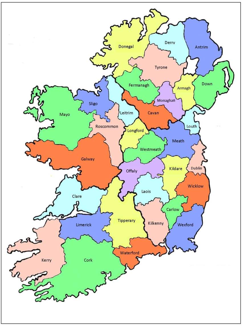
Map of the Counties of Ireland
Roscommon
-
1685 - County of RoscommonBy William Petty.
-
1728 - The County of RoscommonBy Hermann Moll. 'With the Great Roads and Principal Cross-Roads, shewing the computed Miles from Town to Town'
-
1776 - RoscommonAn Hibernian Atlas by Bernard Scale. County Roscommon is Plate 20 which is on page 57 of this digital version. General description of the county is on page 56.
-
1770 - 1840 - RoscommonBy John Longfield and others. About 110 maps for areas in County Roscommon are available to view in the Longfield Map Collection.
-
1810 - 1814 - RoscommonProduced for the Bog Commissioners of Ireland. To find the maps for Roscommon, first filter by Province and select Connaught.
-
1817 - County of RoscommonBy William Edgeworth and Richard Griffith. [Available online in 2 sheets]
-
1832 - Statistical Survey of the County of RoscommonBy Isaac Weald. Though the 1817 Grand Jury Map by Edgeworth and Griffith is not printed in this book, frequent reference is made to it.
-
1846 - RoscommonBy Samuel Lewis. From Lewis's Atlas comprising the counties of Ireland, and a general map of the kingdom.
-
1880 - Map of AthloneScale: three inches to one statute mile. Created by Ordnance Survey of Ireland. Published for the Municipal Boundaries Commission. The Municipal Boundaries Commission was established by the House of Commons to determine the boundaries and ward divisions of boroughs electing members of parliament.
-
1880 - Map of BoyleScale: three inches to one statute mile. Created by Ordnance Survey of Ireland. Published for the Municipal Boundaries Commission. The Municipal Boundaries Commission was established by the House of Commons to determine the boundaries and ward divisions of boroughs electing members of parliament.
-
1880 - Map of Roscommon [Town]Scale: three inches to one statute mile. Created by Ordnance Survey of Ireland. Published for the Municipal Boundaries Commission. The Municipal Boundaries Commission was established by the House of Commons to determine the boundaries and ward divisions of boroughs electing members of parliament.
-
1891 - Roscommon Townby Ordnance Survey. Maps of Roscommon Town are published at five feet to one statute mile scale.
-
1898 - Counties Galway, King's, Roscommon and Westmeathby Ordnance Survey Ireland. This Galway, Offaly, Roscommon and Westmeath map includes Athlone, Ballydangan, Ballynahown, Clonmacnoise, Ferbane, Moate and Shannonbridge. Sheet 108. Scale one inch to one mile.
-
1900 - Roscommonby P W Joyce. Map included in the book 'Atlas and cyclopedia of Ireland' which can be read here https://www.libraryireland.com/Atlas/Roscommon.php
Sligo
-
1685 - County of SligoBy William Petty.
-
1728 - The Counties of Sligo and MayoBy Hermann Moll. 'With the Great Roads and Principal Cross-Roads, shewing the computed Miles from Town to Town'
-
1776 - SligoAn Hibernian Atlas by Bernard Scale. County Sligo is Plate 16 which is on page 49 of this digital version. General description of the county is on page 48.
-
1819 - A map of the county of SligoBy William Larkin. [Available online in 6 sheets]
-
1846 - SligoBy Samuel Lewis. From Lewis's Atlas comprising the counties of Ireland, and a general map of the kingdom.
-
1875 - Sligo Townby Ordnance Survey. Ten feet to one mile.
-
1899 - County Sligoby Ordnance Survey Ireland. Map includes Ballysadare, Collooney, Sligo town and environs, Drumkeeran and Lough Gill. Sheet 55. Scale one inch to one mile.
-
1900 - Sligo Countyby P W Joyce. Map included in the book 'Atlas and cyclopedia of Ireland' which can be read here https://www.libraryireland.com/Atlas/Sligo.php
-
Mapping Sligo in the early nineteenth century : with an atlas of William Larkin's map of County Sligo, 1819.by Arnold Horner, published by Wordwell, 2011. ISBN 978 1 905569 52 6
-
Sligoby Fióna Gallagher and Marie-Louise Legg, published by the Royal Irish Academy, 2012. Irish Historic Towns Atlas No. 24. ISBN 9781904890775
-
Sligo - Irish Historic Towns Atlas OnlineCreated by Irish Historic Town Atlas by the Royal Irish Academy, 2016.The online version contains the cover, general abbreviations, essay, topographical information, select bibliography, maps 1, 2 and 3, growth map and the legend sheet to map 2.
Tipperary
-
1685 - County of TipperaryBy William Petty.
-
1728 - The County or Palatinate of Tipperary with the Counties of Waterford and KilkennyBy Hermann Moll. 'With the Great Roads and Principal Cross-Roads, shewing the computed Miles from Town to Town'
-
1776 - TipperaryAn Hibernian Atlas by Bernard Scale. County Tipperary is Plate 37 which is on page 91 of this digital version. General description of the county is on page 90.
-
1770 - 1840 - TipperaryBy John Longfield, John Brownrigg and others. Maps for areas in County Tipperary are available to view in the Longfield Map Collection.
-
1810 - 1814 - TipperaryProduced for the Bog Commissioners of Ireland. To find the maps for Tipperary, first filter by Province and select Munster.
-
1826 - Map and section of an intended railway or tram road between the cities of Limerick & WaterfordRailway line by Alexander Nimmo. Map created by Benjamin Meredith. Full title = Map and section of an intended railway or tram road between the cities of Limerick & Waterford with branches to Thurles, Killenaule and Carrick. Map includes City of Waterford, Carrick-on-Suir, Killenaule, Clonmel, Cahir, Tipperary Town, Limerick City.
-
1870s -1880s - Towns in County TipperaryThese Tipperary towns are published at ten feet to one statute mile scale : Carrick on Suir (1886), Cashel (1884), Clonmel (1874), Nenagh (1879), Thurles (1889)
-
1880 - Tipperary Townby Ordnance Survey. Published at ten feet to one statute mile scale.
-
1880 - Map of Carrick-on-SuirScale: three inches to one statute mile. Created by Ordnance Survey of Ireland. Published for the Municipal Boundaries Commission. The Municipal Boundaries Commission was established by the House of Commons to determine the boundaries and ward divisions of boroughs electing members of parliament.
-
1880 - Map of CashelScale: six inches to one statute mile. Created by Ordnance Survey of Ireland. Published for the Municipal Boundaries Commission. The Municipal Boundaries Commission was established by the House of Commons to determine the boundaries and ward divisions of boroughs electing members of parliament.
-
1880 - Map of NenaghScale: three inches to one statute mile. Created by Ordnance Survey of Ireland. Published for the Municipal Boundaries Commission. The Municipal Boundaries Commission was established by the House of Commons to determine the boundaries and ward divisions of boroughs electing members of parliament.
-
1880 - Map of TemplemoreScale: three inches to one statute mile. Created by Ordnance Survey of Ireland. Published for the Municipal Boundaries Commission. The Municipal Boundaries Commission was established by the House of Commons to determine the boundaries and ward divisions of boroughs electing members of parliament.
-
1880 - Map of ThurlesScale: two inches to one statute mile. Created by Ordnance Survey of Ireland. Published for the Municipal Boundaries Commission. The Municipal Boundaries Commission was established by the House of Commons to determine the boundaries and ward divisions of boroughs electing members of parliament.
-
1880 - Map of Tipperary [Town]Scale: two inches to one statute mile. Created by Ordnance Survey of Ireland. Published for the Municipal Boundaries Commission. The Municipal Boundaries Commission was established by the House of Commons to determine the boundaries and ward divisions of boroughs electing members of parliament.
-
1898 - Counties King's, Queen's and Tipperaryby Ordnance Survey Ireland. Map includes Roscrea, Shinrone and Cloughjordan. Sheet 126. Scale one inch to one mile.
-
1900 - County of Tipperaryby P W Joyce. Map included in the book 'Atlas and cyclopedia of Ireland' which can be read here https://www.libraryireland.com/Atlas/Home.php
-
Fethardby Tadhg O'Keeffe, published by the Royal Irish Academy, 2003. Irish Historic Towns Atlas No. 13. ISBN 9780954385576
Waterford
-
1673 - Waterford CityPublished in the book 'The history, topography and antiquities of the county and city of Waterford' by J H Ryland, 1824
-
1685 - County of WaterfordBy William Petty
-
c 1700 - The Citty of WaterfordHeld in the British Library - Part of the Topographical Collection of George III, King of Great Britain, 1738-1820
-
1728 - The County or Palatinate of Tipperary with the Counties of Waterford and KilkennyBy Hermann Moll. 'With the Great Roads and Principal Cross-Roads, shewing the computed Miles from Town to Town'
-
1746 - County of WaterfordBy Charles Smith 'A New and Correct Map of County of Waterford'
-
1764 - Waterford CityBy William Richards and & Bernard Scale. Scale of 1:2500. 'A Map of the City and Suburbs'.
-
1770 - 1840 - WaterfordBy John Longfield, John Brownrigg and others. About 11 maps for areas in county Waterford are available to view in this Longfield Map Collection.
-
1776 - WaterfordAn Hibernian Atlas by Bernard Scale. County Waterford is Plate 33 which is on page 83 of this digital version. General description of the county is on page 82.
-
1787 - WaterfordBy Robert Sayer. 'An actual survey of the harbour and river of Waterford and of the bay of Tramore'
-
1818 - Map of the County of WaterfordBy William Larkin. [Available online in 6 sheets]
-
1830 - Waterford CityCreated by Nicholas Sinnott. Colour map of Waterford City showing the parish boundaries. Includes an index with the street names as numbered on the map and also includes significant buildings such as the Town Hall; Cathedral; Old Courthouse; Wesleyan Chapel; Ballybricken Chapel; Female Blue School and others.
-
1834 - Waterford CityBy Patrick Leahy. 'Map of the City of Waterford and its Environs'
-
1846 - WaterfordBy Samuel Lewis. From Lewis's Atlas comprising the counties of Ireland, and a general map of the kingdom.
-
1871 - 1908 Waterford Cityby Ordnance Survey. Maps of Waterford are published at five feet to one statute mile scale.
-
1880 - Dungarvanby Ordnance Survey. Maps of Dungarvan are published at ten feet to one statute mile scale.
-
1880 - Map of LismoreScale: three inches to one statute mile. Created by Ordnance Survey of Ireland. Published for the Municipal Boundaries Commission. The Municipal Boundaries Commission was established by the House of Commons to determine the boundaries and ward divisions of boroughs electing members of parliament.
-
1896 - Waterford Borough BoundariesMap of Waterford City showing borough boundary and electoral wards based on a plan by George Hotham of 1831 and borough boundaries as at 1896.
-
1900 - County of Waterfordby P W Joyce. Map included in the book 'Atlas and cyclopedia of Ireland' which can be read here https://www.libraryireland.com/Atlas/Waterford.php
-
Digital Atlas of DungarvanCreated by Irish Historic Town Atlas by the Royal Irish Academy, 2020.The Digital Atlas of Dungarvan is an interactive map providing detailed historical information about Dungarvan's streets, buildings and sites, overlaying them on a series of town plans of different dates.
Westmeath
-
1685 - County of Westmeathby William Petty.
-
1728 - The Counties of Longford, Meath and Eastmeathby Hermann Moll. 'With the Great Roads and Principal Cross-Roads, shewing the computed Miles from Town to Town'. Includes the county which is now named Westmeath.
-
1770 - 1840 - WestmeathAbout 35 maps for areas in County Westmeath are available to view in the Longfield Map Collection.
-
1776 - WestmeathAn Hibernian Atlas by Bernard Scale. County Westmeath is Plate 5 which is on page 27 of this digital version. General description of the county is on page 26.
-
1808 - Westmeathby William Larkin. 'A map of the County of Westmeath'
The map is also available to view in Trinity College Dublin's Digital Collections at: https://doi.org/10.48495/p2676x27f -
1810 - 1814 - WestmeathProduced for the Bog Commissioners of Ireland. To find the maps for Westmeath, first filter by Province and select Leinster.
-
1846 - WestmeathBy Samuel Lewis. From Lewis's Atlas comprising the counties of Ireland, and a general map of the kingdom.
-
1900 - Westmeathby P W Joyce. Map included in the book 'Atlas and cyclopedia of Ireland' which can be read here https://www.libraryireland.com/Atlas/Westmeath.php
-
1898 - King's County and County Westmeathby Ordnance Survey Ireland. This Offaly and Westmeath map includes Clara, Daingean (formerly Philipstown), Rochfortbridge, Tyrrellspass and Tullamore. Sheet 109. Scale one inch to one mile.
-
1898 - Counties Galway, King's, Roscommon and Westmeathby Ordnance Survey Ireland. This Galway, Offaly, Roscommon and Westmeath map includes Athlone, Ballydangan, Ballynahown, Clonmacnoise, Ferbane, Moate and Shannonbridge. Sheet 108. Scale one inch to one mile.
-
1874 - Athloneby Ordnance Survey. Maps of Athlone are published at ten feet to one statute mile scale.
-
1880 - Map of AthloneScale: three inches to one statute mile. Created by Ordnance Survey of Ireland. Published for the Municipal Boundaries Commission. The Municipal Boundaries Commission was established by the House of Commons to determine the boundaries and ward divisions of boroughs electing members of parliament.
-
AthloneBy Harman Murtagh, published by the Royal Irish Academy, 1994. Irish Historic Towns Atlas No. 6. ISBN 9781874045137
-
Athlone - Irish Historic Towns Atlas OnlineCreated by Irish Historic Town Atlas by the Royal Irish Academy, 2016. The online version contains the cover, general abbreviations, essay, topographical information, select bibliography, maps 1, 2, and 3 and the legend sheet to map 2.
-
1874 - Mullingarby Ordnance Survey. Maps of Mullingar are published at ten feet to one statute mile scale.
-
1880 - Map of MullingarScale: one inch to one statute mile. Created by Ordnance Survey of Ireland. Published for the Municipal Boundaries Commission. The Municipal Boundaries Commission was established by the House of Commons to determine the boundaries and ward divisions of boroughs electing members of parliament.
-
MullingarBy J.H. Andrews and K.M. Davies, published by the Royal Irish Academy, 1992. Irish Historic Towns Atlas No. 5. ISBN 9780901714985
Wexford
-
1685 - County of Wexfordby William Petty.
-
1728 - The Counties of Wicklow, Carlow and Wexfordby Hermann Moll. Title on the map is 'The Counties of Wicklow, Catherlogh, and Wexford' 'With the Great Roads and Principal Cross-Roads, shewing the computed Miles from Town to Town'.
-
1770 - 1840 - WexfordAbout 15 maps for areas in County Wexford are available to view in the Longfield Map Collection.
-
1776 - WexfordAn Hibernian Atlas by Bernard Scale. County Wexford is Plate 12 which is on page 41 of this digital version. General description of the county is on page 40.
-
1816 - Wexford CountyBy Valentine Gill. Title on the map is 'A new map of the county of Wexford from actual survey'. This is the second edition, the first was published in 1811.
-
1846 - WexfordBy Samuel Lewis. From Lewis's Atlas comprising the counties of Ireland, and a general map of the kingdom.
-
1880 - Map of New RossScale: three inches to one statute mile. Created by Ordnance Survey of Ireland. Published for the Municipal Boundaries Commission. The Municipal Boundaries Commission was established by the House of Commons to determine the boundaries and ward divisions of boroughs electing members of parliament.
-
1881 - New Rossby Ordnance Survey. Maps of New Ross are published at ten feet to one statute mile scale.
-
1882 - Wexford Townby Ordnance Survey. Maps of Wexford Town are published at ten feet to one statute mile scale.
-
1880 - Map of EnniscorthyScale: three inches to one statute mile. Created by Ordnance Survey of Ireland. Published for the Municipal Boundaries Commission. The Municipal Boundaries Commission was established by the House of Commons to determine the boundaries and ward divisions of boroughs electing members of parliament.
-
1886 - Enniscorthyby Ordnance Survey. Maps of Enniscorthy are published at ten feet to one statute mile scale.
-
1900 - Wexfordby P W Joyce. Map included in the book 'Atlas and cyclopedia of Ireland' which can be read here https://www.libraryireland.com/Atlas/Wexford.php
Wicklow
-
1685 - County of Wicklowby William Petty.
-
1728 - The Counties of Wicklow, Carlow and Wexfordby Hermann Moll. Title on the map is 'The Counties of Wicklow, Catherlogh, and Wexford' 'With the Great Roads and Principal Cross-Roads, shewing the computed Miles from Town to Town'.
-
1770 - 1840 - WicklowAbout 35 maps for areas in County Wicklow are available to view in the Longfield Map Collection.
-
1776 - WicklowAn Hibernian Atlas by Bernard Scale. County Wicklow is Plate 10 which is on page 37 of this digital version. General description of the county is on page 36.
-
1800 - Map of the County of WicklowDate is approx 1800. By Arthur R. Neville. Published: Dublin: William Allen, 32 Dame Street.
-
1801 - County of Wicklow'A map of the County of Wicklow' [Map is shown on page 16 of the PDF]
-
1813 - County of Wicklowby RIchard Griffith. 'Map of the mountainous and uncultivated parts of the Counties of Dublin and Wicklow'
-
1855 - County of Wicklowby Fraser .'County of Wicklow, including the Environs of the City of Dublin'. Link to map image: https://tinyurl.com/yds42yfz
-
1898 - Counties Carlow, Kildare and Wicklowby Ordnance Survey Ireland. Map includes Dunlavin, Baltinglass, Rathdangan and Ballitore. Sheet 129. Scale one inch to one mile.
-
1900 - Wicklowby P W Joyce. Map included in the book 'Atlas and cyclopedia of Ireland' which can be read here https://www.libraryireland.com/Atlas/Wicklow.php
-
1880 - Map of ArklowScale: three inches to one statute mile. Created by Ordnance Survey of Ireland. Published for the Municipal Boundaries Commission. The Municipal Boundaries Commission was established by the House of Commons to determine the boundaries and ward divisions of boroughs electing members of parliament.
-
1885 - Arklowby Ordnance Survey. Maps of Arklow are published at ten feet to one statute mile scale.
-
BrayBy K.M. Davies, published by the Royal Irish Academy, 1998. Irish Historic Towns Atlas No. 9. ISBN 9781874045649
-
Bray - Irish Historic Towns Atlas OnlineCreated by Irish Historic Town Atlas by the Royal Irish Academy, 2016. The online version contains the cover, general abbreviations, essay, topographical information, select bibliography, maps 1, 2, 3, 8 (growth map) and the legend sheet to map 2.
-
1870 - Brayby Ordnance Survey. Maps of Bray are published at ten feet to one statute mile scale.
-
1883 - Greystonesby Ordnance Survey. Maps of Greystones are published at five feet to one statute mile scale.
-
1895 - Wicklow Townby Ordnance Survey. Maps of Wicklow Town are published at five feet to one statute mile scale.

This work is licensed under a Creative Commons Attribution-NonCommercial-ShareAlike 4.0 International License